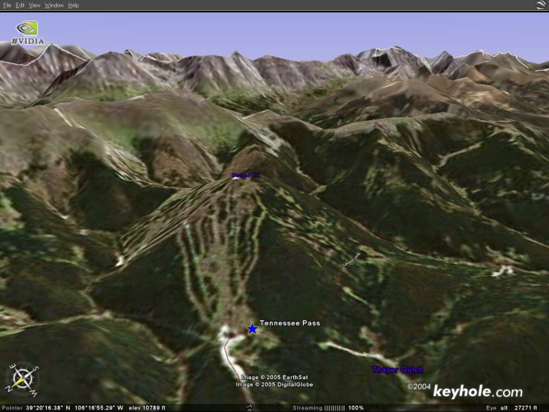
Overhead View of Tennessee Pass
Mountain Madness Preview
| Back to Introduction | ||||
| Back To Day 1 | Forward To Day 3 |
DAY 2 – SKI COUNTRY
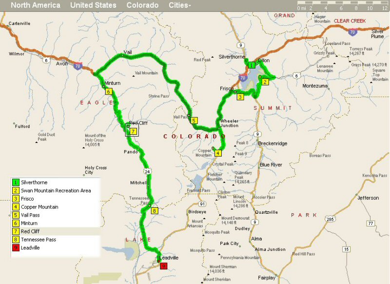
Monday June 20, Silverthorne to Leadville (77 Miles)
Today’s tour traverses Summit and Eagle Counties where they mine gold
the modern way, tourism and skiing. The route crosses Swan Mountain (a mere
bump) with beautiful views of Lake Dillon before picking up the bike path in
Frisco. From Frisco, the bike path will take you through Copper
Mountain and up over Vail Pass (10,700 ft.) before dropping into
the Vail valley. Hang onto your billfolds y’all! After Vail the route
passes through Minturn
on the way to Battle Mountain Summit (9,295 ft.) and Red
Cliff. The view from the bridge at Red Cliff is one of the most
scenic vistas in Colorado. From Red Cliff the road climbs past Camp
Hale, home of the 10th
Mountain Division and up to the continental divide at Tennessee
Pass (10,479 ft.) before reaching the day’s destination of
Leadville
(the highest incorporated town in the U.S.A at 10,210 ft.). Leadville
is a turn-of-the-century mining town with lots of Victorian
charm.
The principal difficulties of the day will be Swan Mountain, Vail Pass, Battle Mountain and Tennessee Pass.
Overhead View of Tennessee Pass |
Accommodations in Leadville at the Timberline Motel are rustic (Colorado code for a little funky) but clean. The motel has a hot tub and is located in the historic downtown area near nice restaurants and watering holes. It is also within walking distance of the National Mining Museum which is worth a visit if you have time.
There is an interesting restaurant in Leadville that primarily serves meat: When you walk in they ask you "What size filet mignon or prime rib you would like?" (depending on which night of the week you visit). They do have a token vegitarian lasagna. Perhaps not the best place for people who are going to ride their bikes 78 miles the next day.... Nevermind.
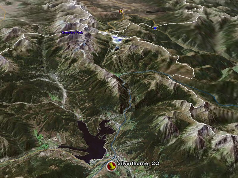
Below you will find a view from Keyhole showing the start of the day at the bottom (with a larger pushpin) and the end of the day at the top (with a smaller pushpin).
*** Note These Satellite Photos and Maps are Only Suggestive of Our Route ***
*** Note These Satellite Photos and Maps are Only Suggestive of Our Route ***
*** Note These Satellite Photos and Maps are Only Suggestive of Our Route ***
| Back to Introduction | ||||
| Back To Day 1 | Back To CrazyGuy | Forward To Day 3 |