DAY 3 – ROARING FORK
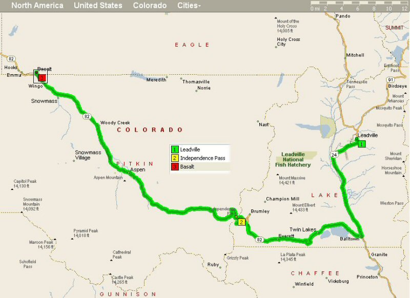
Tuesday June 21, Leadville to Basalt (78 Miles)
Three thousand feet of climbing is hardly worth getting on your bike for, but
if you ignore the first and only climb of the day, the five thousand-foot descent
over the last forty miles of the route should result in Lance-like improvements
to your average speed. The ride follows highway 24 south out of Leadville along
the foot of the Sawatch Range before turning west at Balltown to start the climb
up Independence Pass.
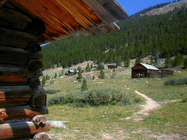
About 3 miles after Independence Pass there is Independence
Ghost Town. There are four or five buildings in a beautiful setting.
It must have been wonderful to be here 100 years ago. Even better is Ashcroft
Ghost Town a couple of miles outside of Aspen before the Maroon Bells.
The 14 mile climb to the continental divide (12,095 ft.) gains almost three
thousand feet as you pass between the Hunter-Fryingpan and Collegiate Peaks
Wilderness Areas. Descend into Aspen at a high rate of speed applying your brakes
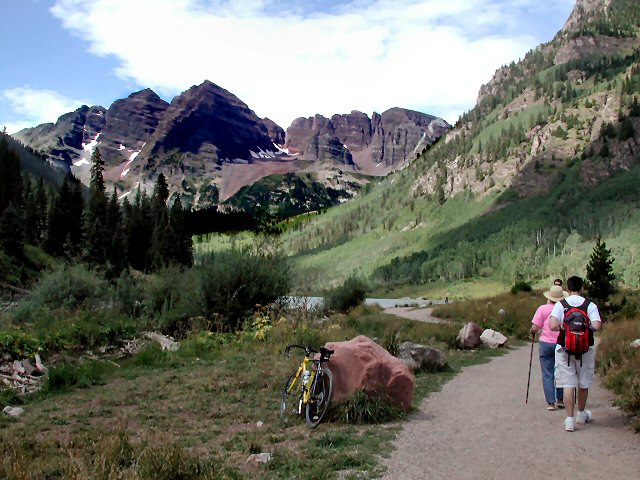
as needed to miss the beautiful people. Be sure to enjoy the view of the Maroon
Bells as you pass through Aspen.
The hike into the Maroon
Bells is one of the prettiest hikes I've been on. The Maroon Bells
are also one of the most dangerous places to climb in the Rockies -- largely
because unqualified people try to climb them and get into trouble.
The road from Aspen descends gently to Basalt at the confluence of the Roaring
Fork and Fryingpan rivers.
Only one difficult thing today: Independence Pass.
Independence Pass
Enjoy. Accommodations in Basalt are located on the Fryingpan River at the Best
Western Aspenalt Lodge (hot tub, continental breakfast, and wall-to-wall trout).
Shops and restaurants in downtown Basalt are just a block away.
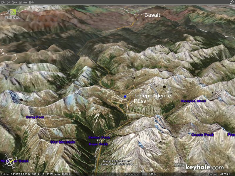
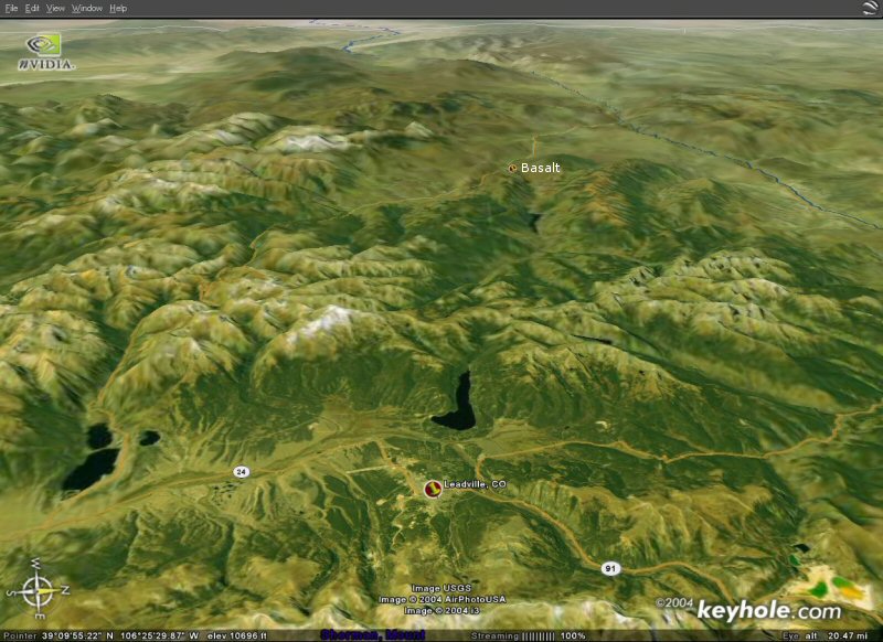
Below you will find a view from Keyhole showing the start of the day at the
bottom (with a larger pushpin) and the end of the day at the top (with a smaller
pushpin).
*** Note These Satellite Photos
and Maps are Only Suggestive of Our Route ***
*** Note These Satellite Photos
and Maps are Only Suggestive of Our Route ***
*** Note These Satellite Photos
and Maps are Only Suggestive of Our Route ***